The Strange Line Visible From the Sky
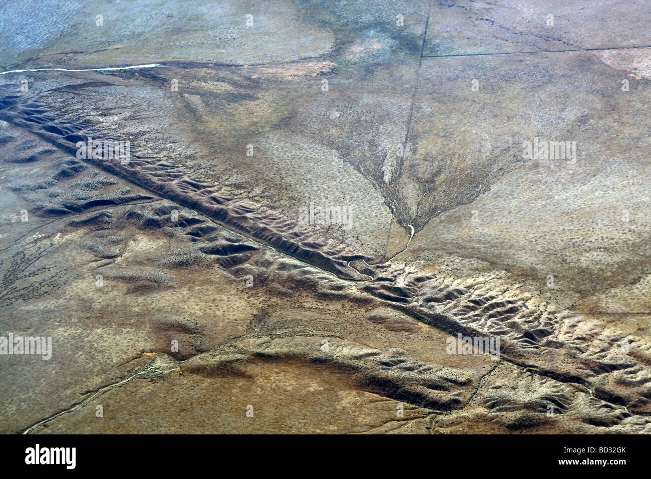
Every day, thousands of travelers cross California’s skies.
Most stare out the airplane window and see nothing unusual.
A narrow valley.
A chain of lakes.
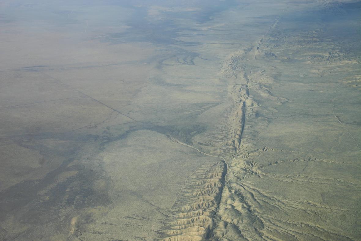
A remarkably straight line cutting across the landscape.
To most passengers, it is simply another feature of the terrain.
But geologists see something entirely different.
They see a wound.
A colossal scar etched into the Earth’s crust by forces so powerful that they continue to reshape the continent itself.
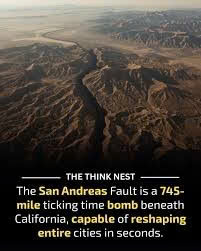
This is the San Andreas Fault.
The most famous fracture on Earth.
And despite its quiet appearance, it has never stopped moving.
An Ancient Crack Hidden Beneath Modern California
Long before Los Angeles, San Francisco, or Silicon Valley existed, California was already being pulled apart by forces beyond human imagination.
Deep underground, two enormous tectonic plates have been locked in an endless struggle for millions of years.
To the west lies the Pacific Plate.
To the east stands the North American Plate.
The boundary between them stretches roughly 750 miles across California, forming one of the most studied geological features on the planet.
From the scorching deserts near the Salton Sea to the rugged coastline of Northern California, the fault slices through mountains, forests, valleys, and rivers like a gigantic scar left behind by some forgotten catastrophe.
Seen from space, the fracture appears almost unnatural.
A line so straight and immense that it seems impossible to be the work of nature.
Yet it is entirely natural.
And it is still growing.
The Invisible Force That Never Sleeps
The terrifying reality of the San Andreas Fault is that it rarely announces itself.
Most of the time, its movement is silent.
Slow.
Almost invisible.
Certain sections slide past one another by only a few centimeters each year—about the same rate that human fingernails grow.
That sounds harmless.
Until you imagine that motion continuing for thousands of years.
Centimeter by centimeter.
Year after year.
Century after century.
Over immense spans of time, mountains are shifted.
Valleys are reshaped.
Rivers are forced into new paths.
Entire landscapes are rewritten.
The chain of lakes visible from aircraft near San Francisco exists partly because of these ancient movements.
The scenery below is not merely beautiful.
It is evidence of a continent slowly being torn apart.
The Sleeping Giant Beneath San Francisco
Not every section of the fault moves freely.
Some portions are locked.
The rocks on either side refuse to slide.
For decades.
Sometimes centuries.
But while the surface appears stable, pressure continues building underground.
Imagine bending a steel bar.
At first, it resists.
Then suddenly it snaps.
That violent release is how major earthquakes are born.
Beneath the densely populated San Francisco Bay Area, enormous amounts of geological stress continue to accumulate.
Hidden.
Silent.
Invisible.
Waiting for the moment when the Earth decides it can no longer hold itself together.
The Morning California Broke Apart
On April 18, 1906, the world witnessed the true power of the San Andreas Fault.
Before sunrise, the fracture violently ruptured.
The break raced across nearly 300 miles of California.
In some locations, the ground shifted more than 20 feet.
Roads split apart.
Fences twisted into impossible shapes.
Buildings collapsed.
Entire sections of the landscape were permanently displaced.
But the earthquake itself was only the beginning.
Massive fires soon engulfed San Francisco, turning one of America’s most vibrant cities into an apocalyptic scene of destruction.
Witnesses described the ground rolling like ocean waves.
Others reported hearing deep, thunderous roars emerging from beneath the Earth.
For many survivors, it felt as though the planet itself had awakened.
Older Than the Pyramids
Many people think of the San Andreas Fault as a modern threat.
In reality, it is unimaginably ancient.
Long before the first stones of Egypt’s pyramids were laid…
Before Stonehenge rose on the plains of Britain…
Before the earliest cities appeared in Mesopotamia…
The fault was already reshaping North America.
For millions of years it has altered mountains, valleys, rivers, and coastlines.
Entire ecosystems have appeared and vanished while the fracture continued its relentless movement.
Its history is not written in books.
It is written in stone.
Every displaced ridge.
Every shifted stream.
Every scar across the landscape preserves another chapter in a story older than humanity itself.

The Boundary Between Two Worlds
Perhaps the most fascinating aspect of the San Andreas Fault is what it represents.
Stand on one side, and you are standing on the Pacific Plate.
Take a few steps across the fault, and you stand on the North American Plate.
Two enormous pieces of Earth’s crust.
Two vast worlds moving in different directions.
Few places on the planet allow humans to witness such a dramatic geological boundary so clearly.
Yet millions cross it every year without realizing it.
The evidence is hidden in plain sight.
Scientists Watching Every Movement
Today, the San Andreas Fault is among the most heavily monitored geological structures in the world.
Satellites track movements measured in millimeters.
Sensitive instruments detect tiny vibrations deep underground.
Researchers constantly analyze how stress accumulates beneath California.
Why?
Because the story is not over.
Every tremor.
Every subtle shift.
Every inch of movement adds another chapter to a geological drama millions of years in the making.
No scientist can predict exactly when the next great rupture will occur.
But everyone agrees on one thing.
It will happen.
The only mystery is when.
Earth’s Most Famous Scar
From the sky, the San Andreas Fault appears peaceful.
A valley.
A line of lakes.
A curious feature stretching toward the horizon.
But beneath that calm landscape lies one of the most powerful geological structures on Earth.
A fracture that has shaped mountains.
Redirected rivers.
Destroyed cities.
And slowly moved entire sections of a continent.
It serves as a reminder of a truth humanity often forgets:
The ground beneath our feet is not as permanent as it seems.
The next time you fly over California and notice that strange line crossing the landscape, remember what you are truly seeing.
Not merely a valley.
Not merely a fault.
But an ancient wound carved into the Earth itself—a colossal scar that continues, inch by inch, to pull a continent apart.